


Fultondale Senior Citizen's Center, Jefferson County, Alabama
About
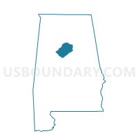
Outline

Summary
| Unique Area Identifier | 522108 |
| Name | Fultondale Senior Citizen's Center |
| County | Jefferson County |
| State | Alabama |
| Area (square miles) | 5.83 |
| Land Area (square miles) | 5.80 |
| Water Area (square miles) | 0.03 |
| % of Land Area | 99.46 |
| % of Water Area | 0.54 |
| Latitude of the Internal Point | 33.60856160 |
| Longtitude of the Internal Point | -86.79550260 |
Maps


Graphs
Select a template below for downloading or customizing gragh for Fultondale Senior Citizen's Center, Jefferson County, Alabama


Neighbors
Neighoring Voting District (by Name) Neighboring Voting District on the Map
- Fultondale First Baptist Church, Jefferson County, AL
- Gardendale Civic Center, Jefferson County, AL
- Harriman Park Recreation Center, Jefferson County, AL
- Hooper City Recreation Center, Jefferson County, AL
- Inglenook Elementary School, Jefferson County, AL
- Jefferson County Rehabilitation Center, Jefferson County, AL
- North Birmingham Recreation Center, Jefferson County, AL
- Tarrant City Hall, Jefferson County, AL
Top 10 Neighboring County Subdivision (by Population) Neighboring County Subdivision on the Map
Top 10 Neighboring Place (by Population) Neighboring Place on the Map
- Birmingham city, AL (212,237)
- Gardendale city, AL (13,893)
- Fultondale city, AL (8,380)
- Tarrant city, AL (6,397)
Top 10 Neighboring Unified School District (by Population) Neighboring Unified School District on the Map
- Jefferson County School District, AL (230,679)
- Birmingham City School District, AL (212,237)
- Tarrant City School District, AL (6,590)
Top 10 Neighboring State Legislative District Lower Chamber (by Population) Neighboring State Legislative District Lower Chamber on the Map
- State House District 51, AL (48,552)
- State House District 60, AL (36,704)
- State House District 59, AL (32,838)
Top 10 Neighboring State Legislative District Upper Chamber (by Population) Neighboring State Legislative District Upper Chamber on the Map
Top 10 Neighboring 111th Congressional District (by Population) Neighboring 111th Congressional District on the Map
Top 10 Neighboring Census Tract (by Population) Neighboring Census Tract on the Map
- Census Tract 117.03, Jefferson County, AL (9,111)
- Census Tract 117.05, Jefferson County, AL (7,695)
- Census Tract 120.02, Jefferson County, AL (6,387)
- Census Tract 109, Jefferson County, AL (4,989)
- Census Tract 119.01, Jefferson County, AL (2,957)
- Census Tract 55, Jefferson County, AL (2,167)